
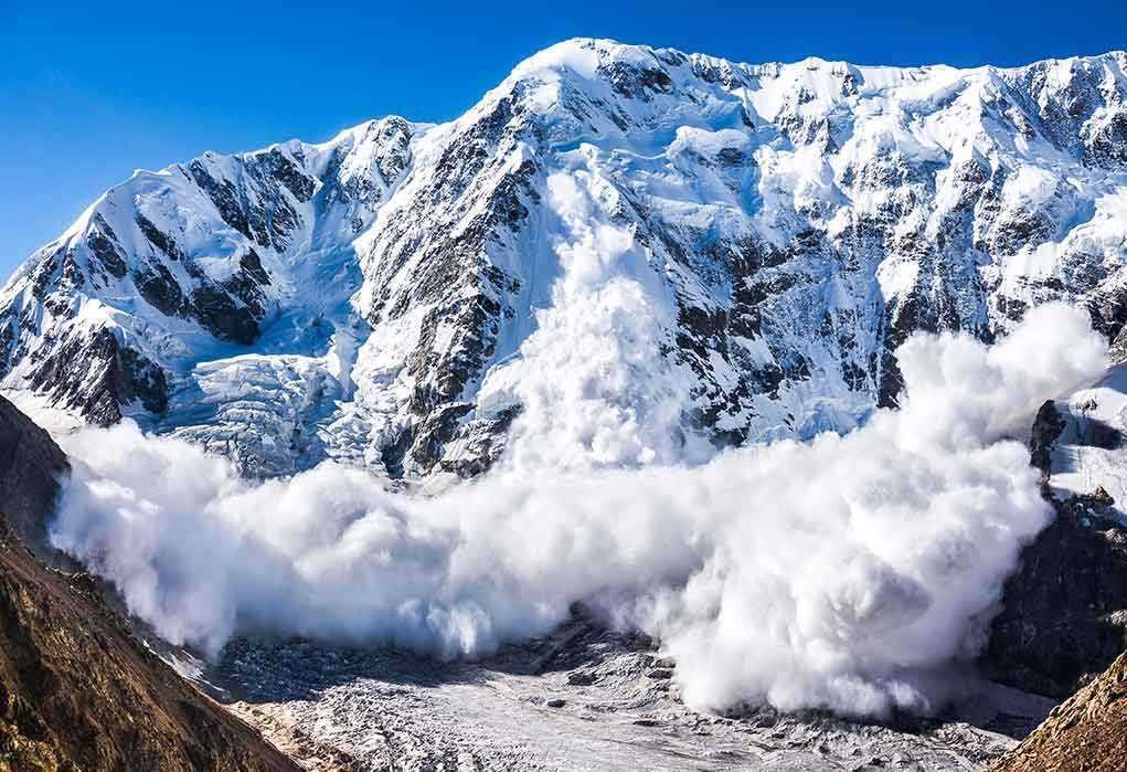
A massive ice avalanche likely triggered a deadly flash flood on Nepal’s border with Tibet, killing more than 150 people and leaving hundreds missing, officials and scientists say.
Story Highlights
- Satellite and seismic evidence points to a glacier-linked ice avalanche as the trigger.
- Authorities report at least 150 deaths and hundreds of missing, including foreign tourists.
- Villages, roads, and hydropower sites suffered heavy damage across the Himalayan corridor.
- Experts say such high-mountain flood risks have a long, documented history across the region.
Scientists Identify Glacier-Linked Trigger Behind Nepal Flood
Scientists analyzing satellite images say an ice avalanche likely set off the catastrophic flood along Nepal’s border with Tibet on Wednesday. A University of Dundee glaciologist reported that preliminary imagery shows a large ice mass broke loose and fell thousands of feet, unleashing debris and water downstream. Seismic readings first looked like an earthquake, but geologists later tied the tremor to the collapse itself, not tectonic movement. This sequence explains the sudden surge that struck remote valleys before dawn.
Officials in Nepal reported more than 150 deaths and hundreds of missing people as rescue teams moved through damaged roads and washed-out bridges. Police and disaster units worked to reach villages cut off by mud, rock, and cold mountain water. Tourism officials said many foreigners were among the missing, reflecting the region’s popular trekking routes. Crews faced thin air, falling rocks, and unstable slopes. Authorities warned that totals could rise as access improves and reports arrive from outlying hamlets.
Scale of Damage Across Border Regions and Key Infrastructure
Local police and regional authorities described villages leveled, bridges twisted, and segments of highways carried downstream. Hydropower projects and work sites suffered serious harm, with equipment buried and channels clogged by debris. In Tibet, state media reported several deaths and many missing, underscoring the cross-border nature of the disaster. Downstream communities braced for more surges as blockages shifted. Engineers and soldiers cleared choke points to lower water levels and reopen critical access lanes.
Early accounts from the International Centre for Integrated Mountain Development in Kathmandu also point to a glacier-sourced avalanche as the likely cause, matching the satellite and seismic findings. The event fits a known pattern in the Himalaya, where rock, ice, and slopes fail together and drive flood waves through narrow valleys. That chain reaction can turn a local collapse into a far-reaching disaster within minutes. Such events strike faster than warnings can move through remote villages and trail zones.
Himalayan Flood Hazards Have Deep Roots and Ongoing Risks
Regional studies show that the Himalaya has seen hundreds of glacial lake and avalanche-driven flood events over the years, with many tied to failing moraines and sudden slope collapses. A scientific review counted at least 388 documented outburst floods across the broader region, showing this hazard is not rare over time. These floods can hit with force levels that rival major monsoon rivers, even far downstream, according to peer-reviewed research on extreme outburst flows. That power explains the widespread damage from a single high-mountain trigger.
Nearly 1,500 people including almost 800 foreigners are missing across Nepal and China's Tibet, authorities said on Thursday, after a wall of mud and rock collapsed into a Himalayan river, sending catastrophic flash floods through towns and valleys.
Read more… pic.twitter.com/m2FmY2GU1d
— DZRH NEWS (@dzrhnews) August 27, 2026
Scientists and planners warn that growth in settlements, roads, and power lines in steep valleys places more people and assets in harm’s way when avalanches and outbursts strike. Mountain corridors need steady monitoring of glaciers, slopes, and lakes, plus clear evacuation plans for communities and tourists. International teams already track risky lakes and unstable slopes, but gaps remain in coverage and in real-time alerts that reach remote areas fast enough to save lives. The Nepal flood shows how minutes matter when walls of water form.
Rescue Priorities and What Comes Next for Travelers and Families
Rescuers focused on search and medical care, family reunification, and restoring mountain roads used for aid and evacuations. Authorities asked travelers to report locations and planned routes so teams can match names to areas of concern. Hospitals prepared for trauma care and exposure cases. Local leaders set up temporary shelters for those who lost homes and gear. Weather teams watched for rain that could loosen slopes further. Officials promised a full review of triggers and response steps once the immediate crisis eases.
For American readers with family or friends in the trek zones, officials advised using embassy hotlines and airline manifests to get updates. United States hikers visit these routes in large numbers every season. Timing, route choices, and group records help speed checks by local police. Relief groups asked for simple supplies: water filters, blankets, first aid kits, and phone chargers. Clear lines of contact help avoid clogging radio nets used by search crews and medical teams moving through narrow valleys.
Why This Matters for Policy and Preparedness
This disaster highlights a basic duty of any government: protect people, alert them early, and keep vital routes open. Mountain nations carry much of that burden, but travelers, guides, and aid groups also need clear rules and reliable warnings. Research shows these compound events will keep testing steep valleys with sudden force. A smart path forward backs better mapping, more sensors, and drills that move people uphill fast when slopes fail. Those steps save lives without bloated programs or empty talk.
Sources:
nytimes.com, thestar.com.my, theguardian.com, thevoice.news, bbc.com, indiatoday.in, aljazeera.com, mhewc.org, lib.icimod.org, icimod.org, pnas.org